
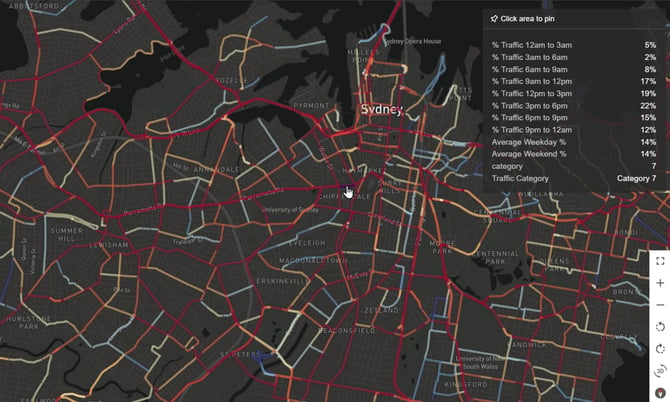
GapMaps Traffic provides you with a macro view of national traffic data across Australian Major Cities. This module is useful for any business which relies on basic traffic data as a key input into their location decisions, such as the estimated average number of vehicles per day in a selected location based on estimated volume ranges.
Traffic estimates are categorised to allow you to easily identify roads with high daily vehicle estimates.
About the data:
Two-way combined annual average daily traffic estimate, visualised via seven indexed categories. Traffic currently covers the below regions in Australia:
- Sydney – including Wollongong and Newcastle
- Melbourne – including Geelong, Ballarat, Bendigo and Warragul.
- South East Queensland – including Gold Coast, Sunshine Coast, Toowoomba and Northern NSW from Tweed Heads to Ballina)
- Adelaide – the greater Adelaide area
- Perth – the greater Perth area
- Adelaide – the greater Adelaide area
- Canberra – including Queanbeyan
- North Queensland – including Cairns, Townsville and Mackay
How GapMaps Traffic can work for you:
- Visualise only the categories that interest you the most.
- Overlay traffic estimates with your network, competitive landscape, layers and other GapMaps features.
- Hover over a road to understand the category, traffic volume, along with time of day and weekday/weekend split.