
GLOBAL | PAID INTEGRATION
If you are interested in enabling GapFinder on your account, reach out to us via chat or get in touch with your Customer Success Manager.
GapFinder is a powerful tool designed to help businesses uncover expansion opportunities. By setting specific conditions and using advanced queries, users can quickly pinpoint optimal locations in which to expand their network based on key variables.
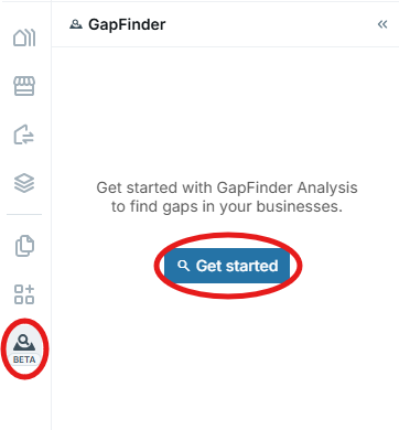
Opening the GapFinder ModuleLocate the GapFinder option in the platform menu and click Get Started to start a new analysis.
Selecting Anchors
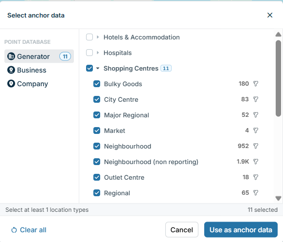
An anchor is a primary reference point for your analysis, typically one or more key location categories that influences surrounding businesses.
Choose Your Anchors – Select one or more location type to base your analysis on (e.g., shopping centre, competitor store, key landmark)
(Optional) Apply Metadata – If metadata is available for your selected anchors, you can apply it at this stage to refine your analysis.
Adding Queries
Queries are essential in GapFinder as they define the conditions that locations must meet to be included in your analysis. They allow you to refine your search based on factors such as demographics, competitor presence, and other key variables. You can add as many queries as needed to create a precise and tailored analysis, ensuring that the results align with your specific business objectives.
Understanding Query Operators:
- AND – Results must meet all conditions.
- OR – Results must meet at least one condition.
Query Types:
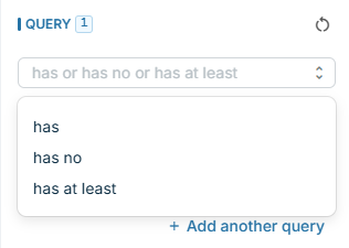
- Has – Defines an exact count or range (e.g., has a population between X and Y).
- Has No – Excludes specific locations or brands (e.g., has no McDonald's).
- Has At Least – Used for POI counts (e.g., has at least 3 of McDonald's, Burger King, Hungry Jack's, Subway, Nando's).
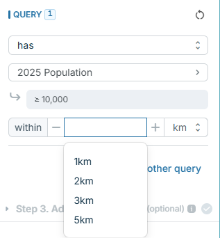
Defining a Radius – All queries must have a radius, which can be set in metres, kilometres, or miles. Choose from a dropdown or enter a custom radius (minimum 0.1, maximum 15).
Setting Ranking Criteria
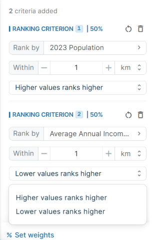
Ranking criteria allow you to prioritise locations based on factors most relevant to your business. While optional, setting ranking criteria helps refine your results by applying weighted importance to different variables. You can define as many ranking criteria as needed, ensuring a customised analysis that aligns with your strategic goals.
Ranking criteria is determined by higher values rank higher or higher values rank lower.
Types of Ranking Criteria:
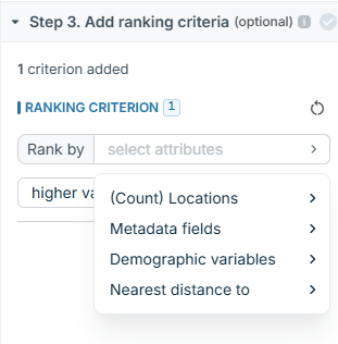
- Count of locations
- Metadata fields (only from anchor sites)
- Demographic variables
- Nearest distance to a key location
Adjusting Weights:
- Add as many criteria as needed.
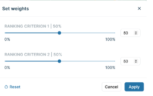
- Click on 'Set Weights'
- Set weights by typing values or using sliders.
- Lock weights for a criterion and adjust others accordingly.
- Click Add a New Criterion to include more factors.
Running the Analysis
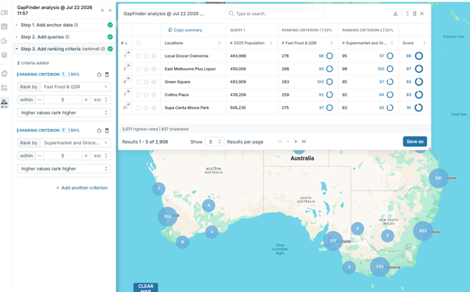
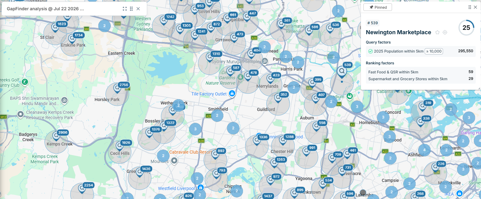
Click Find the Gap – The identified locations will appear on the map, and the dashboard will be visible.
Saving Results:
- Click Save (bottom right), enter a report name, and save again.
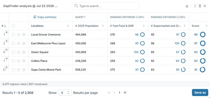
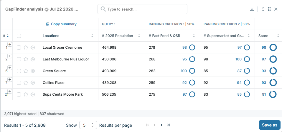
- Results are ordered by rank.
- Query columns can be sorted high to low by clicking the header arrows.
- Copy Summary – Quickly copy a summary of the GapFinder report for board packs or presentations.
Understanding Results
- Scoring Breakdown – Each ranking column shows a breakdown, with an overall score in the final column.
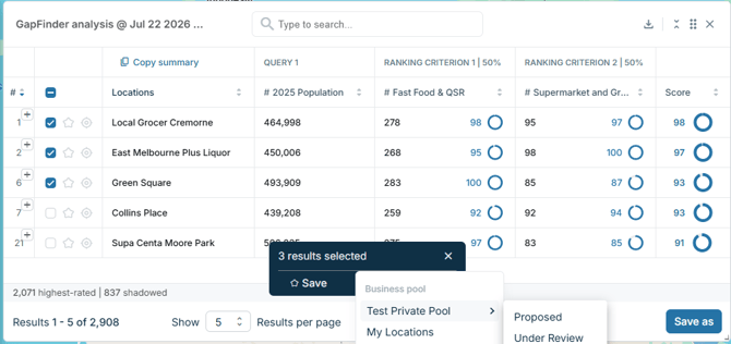
- Saving Individual or Grouped Results:
- Click the star icon to save individual results.
- Select multiple results and save them to a location type within your company.
- Use Zoom to Pin to focus on a specific result on the map.
Shadow Locations
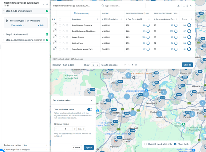
If you have applied ranking criteria, shadow locations will be applied. This means that lower-scoring sites within 100m (default) are shadowed by higher-ranking locations.
- Identifying Shadow Locations – A + icon in the row number indicates a shadow location.
- Adjusting Shadow Radius:
- Go to Dashboard Settings to change the shadow radius.
- Toggle visualisation options for Highest Rated Sites Only or Both Highest Rated and Shadow Sites.
- Choose whether to include shadow sites in exports.
Exporting and Viewing Data
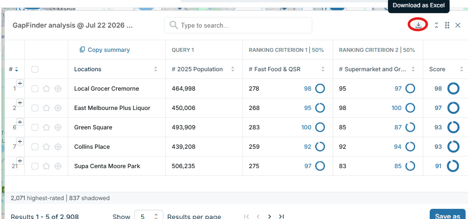
- Download as Excel – Export the GapFinder report as an Excel file.
- Interacting with the Dashboard
- Resize, collapse, or drag the dashboard.
- Click on map pins to view a summary of the GapFinder data for that location.
- Adjust the number of results per page and use search filters.
:
Updating a GapFinder Report
- Make changes to your analysis and click Save As to update your report while keeping the original version intact.
Things to note
GapFinder leverages the datasets GapMaps has available across all markets. Whilst we endeavour to deliver high quality, accurate datasets at all times, results should be used as a guide rather than a definitive recommendation. Users can refine their analysis by adjusting query parameters.