Convenience Lines
An impact or cannibalisation assessment estimates the potential shift in customer traffic from an existing site to a new proposed location, primarily driven by convenience.
During the analysis of the impact, trip patterns are examined to determine customer behaviour. Key factors include where the customer is coming from before visiting the existing site and where they go once they leave.
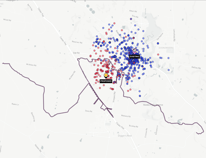
This analysis helps assess whether the existing or proposed site is more convenient for customers, leading to the estimation of an impact percentage. The "convenience line" is crucial in this process, representing the midpoint between the two locations where travel time to each is equal. Customer convenience, based on their trip patterns, is the primary factor in predicting cannibalisation.
The convenience line marks the boundary between the two sites, and standing on this line would result in equal travel time to both sites.
Using Convenience Lines
By default, convenience lines will be visible when visualising an Impact Analysis. You may toggle it on/off by using the convenience toggle in the Impact Analysis panel.

What is an Access Point
Access Points enhance Impact Analysis by allowing users to move the pin for the existing site to it's actual access point, such as the street corner for dual-access sites or curbside for single entry sites. Similarly, the pin for the proposed location can be adjusted to the corner or curbside for better accuracy.
The access tool's benefit lies in preventing extra drive time from being added when navigating within parking lots, ensuring a more accurate convenience line and impact assessment.
 Using Access Points
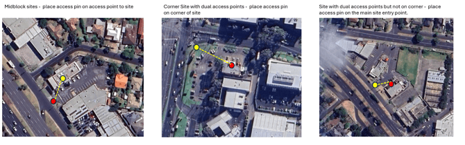
Access points for existing locations need to be set for both existing and proposed locations when creating the Impact Analysis.
Access Points for Existing Locations
⚠️Note:
We recommend using Google or Mapbox Satellite base maps when creating Impact Analysis Reports.
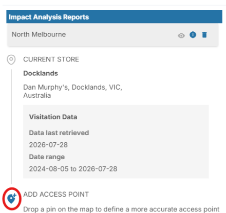
- When creating the Impact Analysis, click the pin icon next to the existing location's address
- Ensure the Access Point is at the location's actual access point
- If the location has two entry points, place the access point on the corner
- For single entry points, place the access point at the curbside
Access Points for Proposed Locations
Proposed location pins should be placed at the access point for that location.
- Search the address for the proposed location
- Click and drag the pin to the location's best access point
Access Points for Proposed Locations
Proposed location pins should be placed at the access point for that location.
- Search the address for the proposed location
- Click and drag the pin to the location's best access point
What is Buffer Time
Buffer Time is an optional filter that can be applied to impact analysis once it has been generated. It refers to the additional minutes (typically 1 to 2) added to one or both legs of a journey. This adjustment accounts for the time people spend walking from their car to the store or site for scenarios such as when parking availability is limited.
For example, in locations such as inline retail stores where parking may be farther from the entrance, Buffer Time ensures a more realistic estimation of the total travel time involved. This helps in refining the analysis for greater accuracy when assessing convenience and customer travel patterns.
How to add Buffer Time
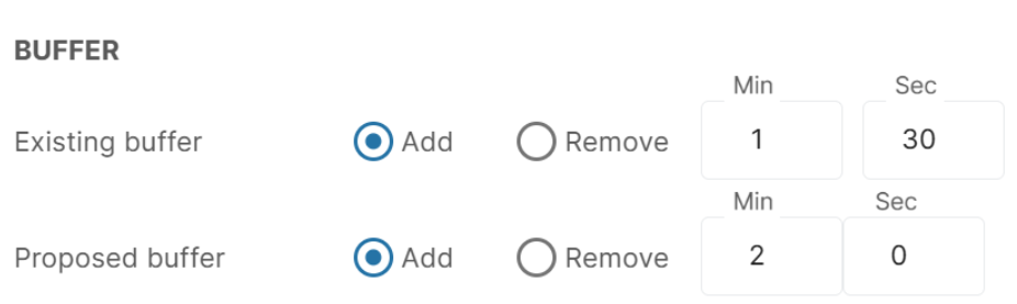
- On a generated Impact Analysis, open Filters
- Enter how many minutes/seconds you wish to add/remove from the existing, proposed or both legs of the journey