
⚠️ ADMIN ACCESS REQUIRED⚠️
If you do not have Admin access, please reach out to client services via the chat icon or at clientservices@gapmaps.com for assistance.
This guide focuses on importing and exporting catchments via .geojson files.
To import a Layer Based Trade Area using geographic boundary codes see this guide.
You can import or export catchments from GapMaps Live via .geojson or .kml files. Importing catchments in this manner will upload them to your platform as trade areas (polygons).
Importing Catchments
If you have catchment boundaries in a digital format that you wish to import to GapMaps Live, ensure the file format is .geojson.
In order to attach the catchments to the correct locations in your account, location_uuid is a mandatory field in your .geojson file. The location_uuid for each catchment needs to correspond with it's assigned location.
To obtain your location uuid's see the export locations guide
These boundaries will be imported to GapMaps as Trade Area Catchments.
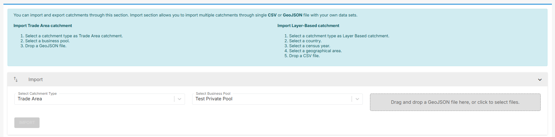
- Go to GapMaps Admin
- Click 'Import/Export Catchments'
- Under the Import section, select 'Trade Area'
- Select the business pool the locations belong to
- Upload the .geojson
- You will receive an email once the import has completed
Exporting Catchments
Exporting catchments will result in a .geojson file being emailed to you.
- Go to GapMaps Admin
- Click 'Import/Export Catchments'
- Under the export section, select the catchment type you wish to export
- Select which business pool and location type's catchments you wish to export
- Click 'Export'
- You will receive an email containing the .geojson file once the export has completed
