
Things to note
Visitation Data reports cannot be created on Search Locations. Please ensure the site you are running the report on is saved to your Company Locations or is a Business Listing/Generator.
Creating a Visitation Data Report
❕TIP ❕
We recommend turning on the satellite base map when creating a Visitation Data report
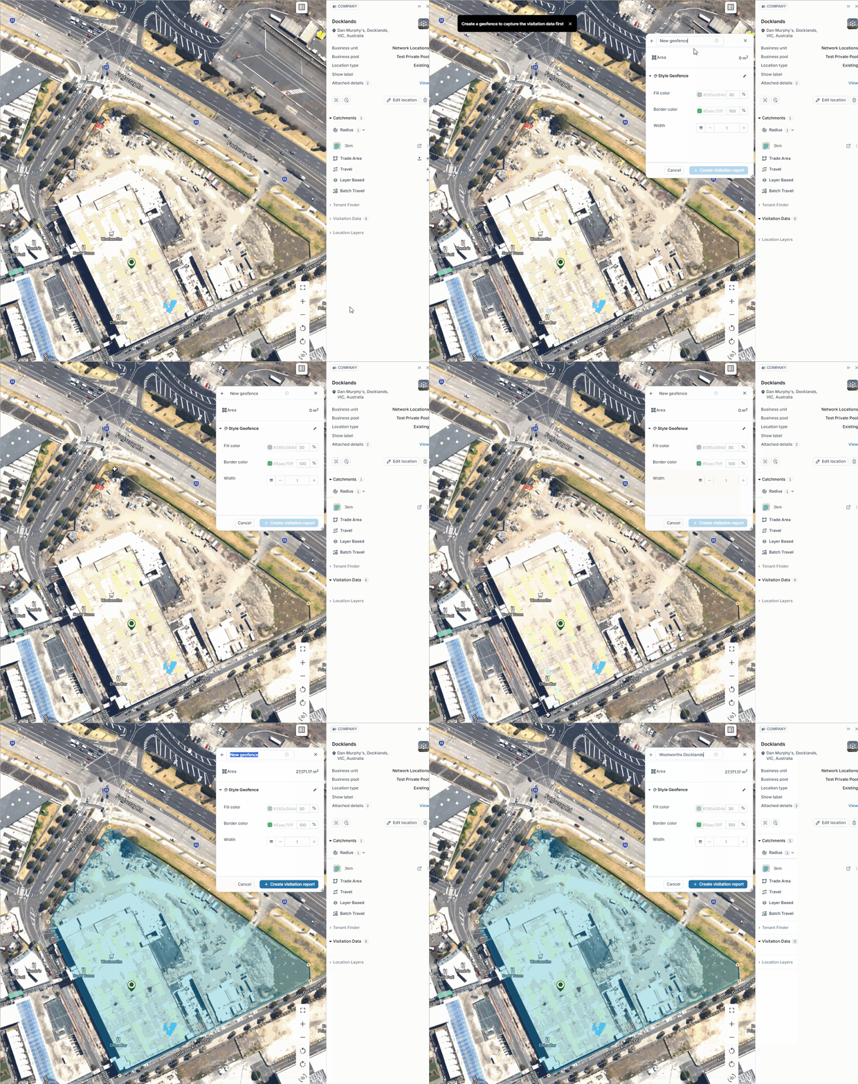
- Click on a pin
- Click on ‘Visitation Data’ in the Pin Panel then click ‘Add’
- Create a geofence by clicking points on the map.
- Double click on the last point to finalise the geofence.
- Name the report.
- Click ‘Create Visitation Report’.
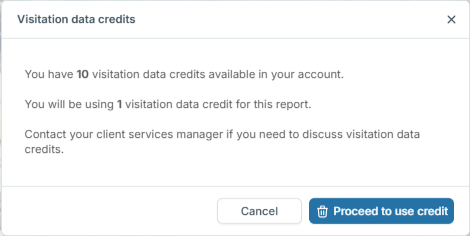
- Click ‘Proceed to Use Credit’.
You will receive an email once the report is ready to view in platform.
❕NOTE: This report takes a minimum of 5 minutes to run.
Visitation Data Report | Tools
- Click on the pin that a visitation report is attached to.
- Click on ‘Visitation Data’.
- Show/Hide - Visualises/hides the report on the map and brings up the Control Panel.
- Info - Displays the date the geofence last retrieved data and the date ranges.
- Edit - Allows you to edit the name or delete the report.
- Dashboard - Opens the Report Dashboard.
- Hovering your mouse over the report will display the geofence on the map.
TIP: Use the MapBox Base Maps to make the polygons easier to visualise.
Visitation Data | Control Panel
Accessing Visitation Data Control Panel:
Enable the Visitation report by toggling it on in the right hand panel.
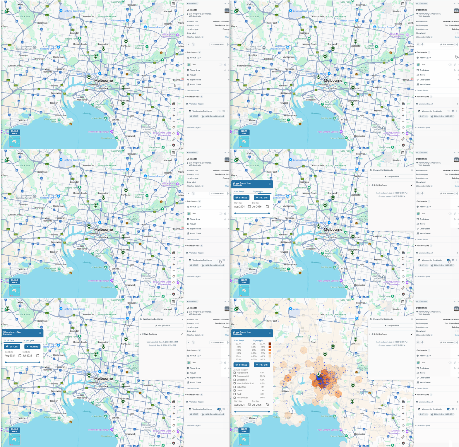
Legend:
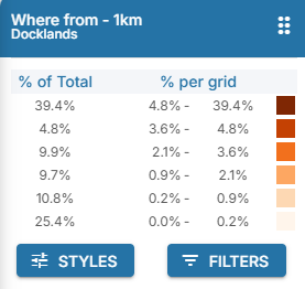
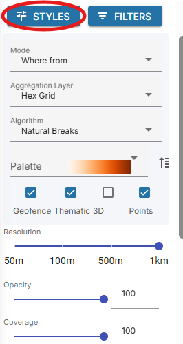
Styles:
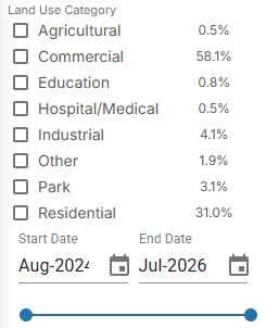
Filters:
Legend
The percentage of the total amount of devices captured / % of total amount of devices captured per grid.
Styles
Mode:
Change the report to display:
- Where from
- Where to
- Shortest from/to leg
- Common Day
- Common Evening
Aggregation Layer:
Display the layer as Hexagons
Algorithm:
Break the legend into Quartile, Decile, Natural Breaks or Manual Breaks.
Palette:
Change the colour palette of the thematic layer.
Checkboxes:
Toggle views of Geofence, Thematic layer, 3D view and Device Points.
Resolution:
Change the size of the polygons.
Filters
** Only Available on Where From, Where To and Shortest From/To Leg.
- See only the devices that attended the pin from a particular land use category.
- Toggle the dates of device data displayed.
Visitation Data Modes
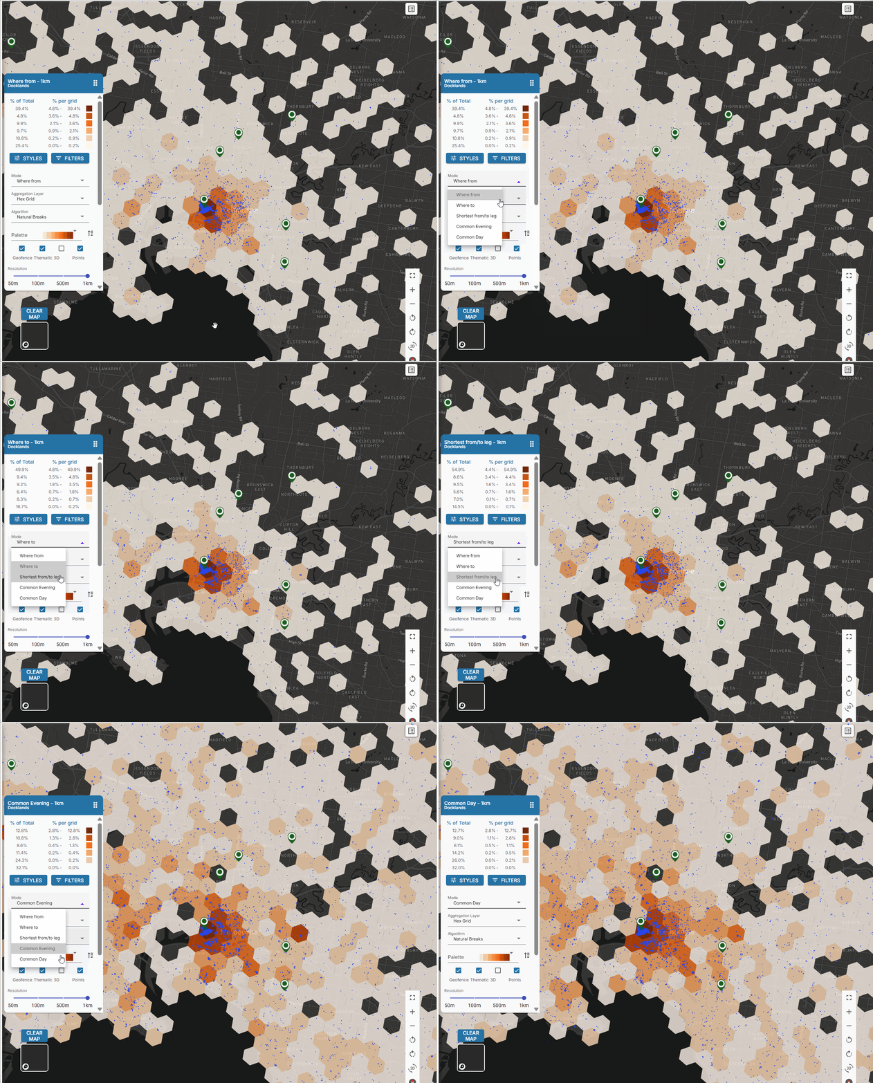
Where From
Where a device is located immediately prior to visiting.
Where To
Where a device is located immediately after visiting the location.
Shortest from/to leg
Short-leg is the term used to define the reason for an individual's trip.
It looks at the shortest distance between where from/where to and identifies a reason for the trip.
Common evening
Where a device rests in the evening.
Common day
Where a device rests in the daytime.